Press
Press & media kit
Updated: 2026-06-16
Thank you for covering BoatClaw. Everything you need to write about the app is gathered here: a short description and one-liner, quotable boilerplate, the story angle, logo and brand notes, high-resolution screenshots, and the key facts. For interviews, custom screenshots, specific platform-version details, or beta-build access, email team@boatclaw.com — a person reads every message.
Short description
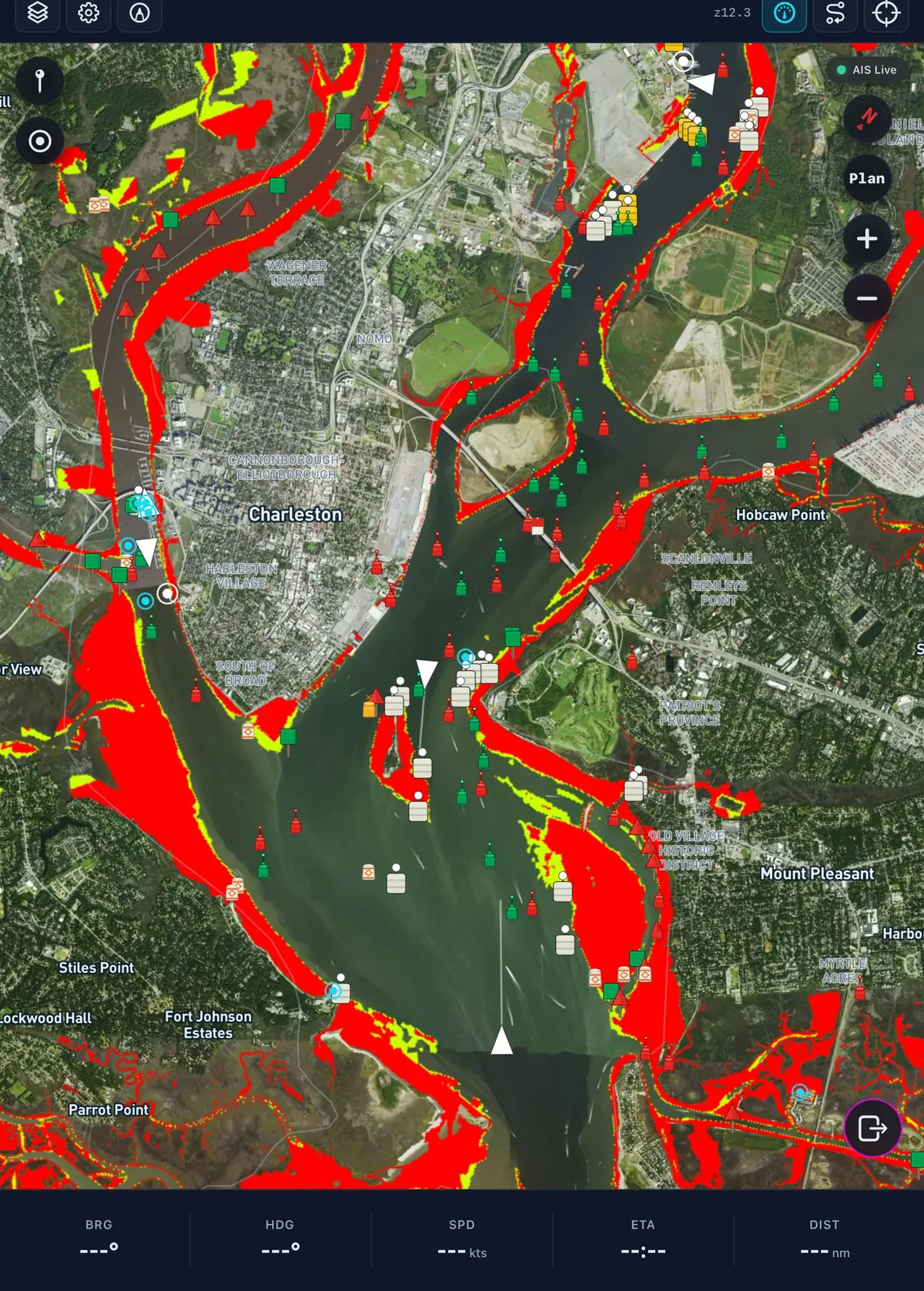
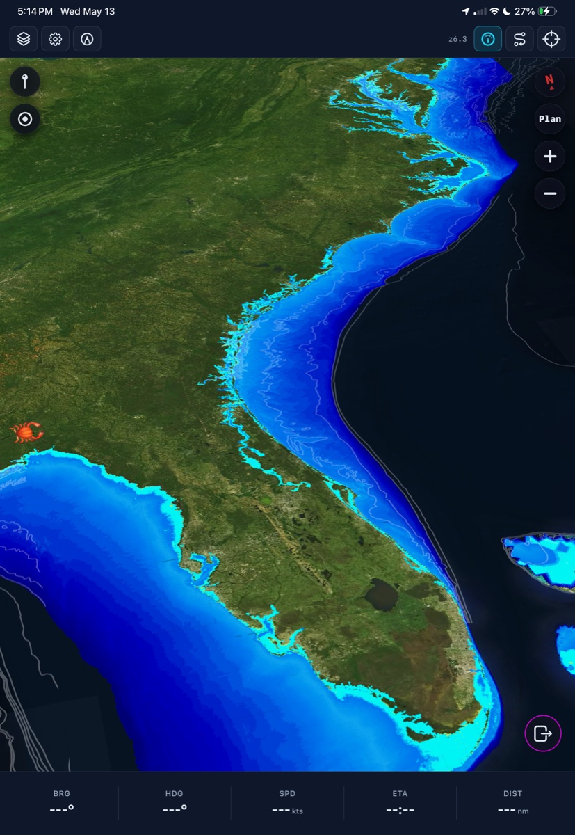
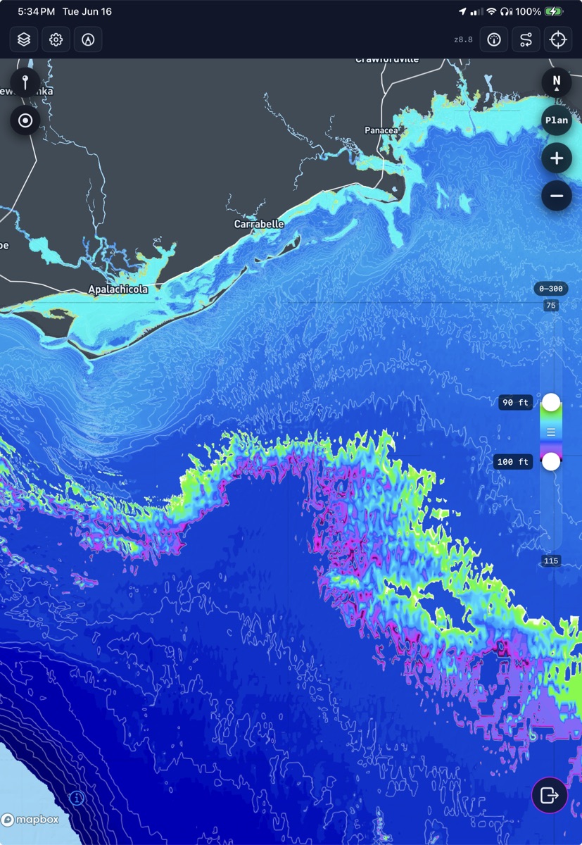
BoatClaw is aviation-grade marine navigation for iPhone and iPad: continuous depth shading, a Hazard Advisor tuned to your boat's draft, and draft-aware routes planned over real bathymetry, weather, radar, and live conditions. Built by Crab Labs, currently in invite-only beta.
One-liner
Aviation-grade situational awareness for boaters — real depth intelligence, severe-weather context, and routes planned over the water you actually run.
Boilerplate paragraph
BoatClaw treats a phone or tablet the way modern aviation treats a glass cockpit: one navigation surface that fuses bathymetry, weather, radar, waves, wind, tides, and live station data into a single layered view a captain can read at a glance underway. Continuous, infrared-style depth shading replaces the flat blue background of most marine apps with a readable safety layer, and the Hazard Advisor flags caution and warning depths tuned to a specific boat's draft. Its passage planner draws routes over real water, real terrain, and forecast conditions — with per-leg ETA, tide, and current, a weather window, and safe harbors along the way — instead of an idealized chart. Rounding it out are AIS collision awareness, tides and currents, marinas with clearance math, Coast Pilot narratives, GPS track logging, and a vessel ownership vault, all in day and night modes with smooth, high-framerate rendering. BoatClaw is built by Crab Labs LLC, a small independent software studio, and runs on iPhone and iPad.
Why it matters
Pilots have had glass-cockpit situational awareness for decades; boaters have been stuck staring at flat-blue charts that stop at the channel edge. BoatClaw exists to close that gap — to port aviation-grade awareness to the water, so the next squall line, the next shoaling bank, and the next tide swing are something you see coming rather than something you discover the hard way. The captain is always responsible at the helm; our job is to make the water in front of them legible, reduce the risk of groundings, and help more crews come home safe.
Logo & brand
Screenshots
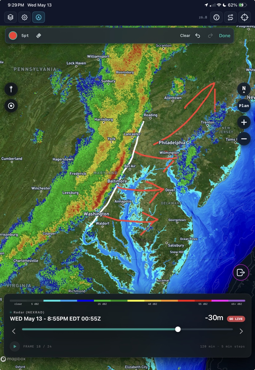
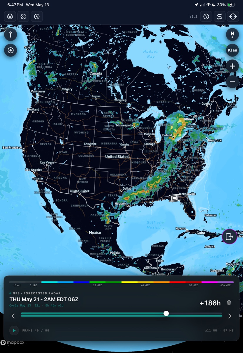
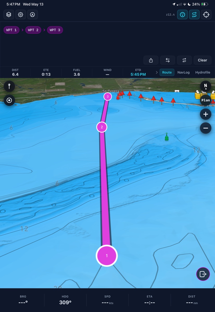
Direct links to high-resolution feature screenshots. Please credit "BoatClaw / Crab Labs" if a credit line is required.
Facts
- Platform: iOS — iPhone & iPad, iOS 18+
- Status: Beta via Apple TestFlight (pre-release, invite-only) — invitations on request
- Maker: Crab Labs LLC, an independent software studio
- Categories: Marine navigation · Outdoor & weather · Boating
- Data sources: NOAA, NWS, NEXRAD, GFS, public AIS, Mapbox basemap
Media contact
team@boatclaw.com — the fastest channel for review-build access, interview requests, press questions, or anything we haven't pre-built here.